GPS is the American System (Global Positioning System) and of course, was the first and forerunner of all other systems. It came into general usage in the eighties and was a revolution in all forms of navigation, including the marine sector.
However, in recent years, more and more systems have also come on-line.
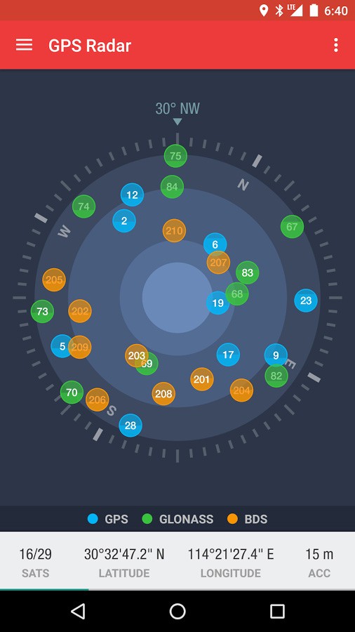
GPS Radar App - Shows the phone is receiving data from GPS, GLONASS & BeiDou-2
Look at this picture, it’s a screenshot from my mobile phone. It’s one of many free App’s that you can download. It’s showing the Satellites that are being used to fix my phones position.
The
blue blobs are GPS, but what about the
green and
orange ones?
The
green are Russian satellites from their
GLONASS constellation. The
orange are Chinese satellites from their system called BeiDou_2, we sometimes refer to this as
COMPASS.
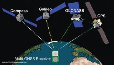
Both GLONASS and BeiDou_2 are full World Wide systems and compliment GPS. So your positioning device, i.e. your phone or dedicated navigation unit are using a mixture of all these satellites to find your location.
But that’s not the whole picture, we also have the new European system called
Galileo.
Despite many delays, this is now up and running, though the full constellation is not fully in place. It doesn’t show on my phone because it’s so new that the chipsets used within our mobile devices aren’t able to pick up the signals. However, the chip processor manufacturers are already ‘on-it’, and future phones and navigation devices will soon be able to receive Galileo as well.
In addition, there are also 2 other systems that complement the constellation, though they are not World Wide. These are
NAVIC, an Indian System &
Quasi-Zenith that is Japanese.
Below is a summary of all these systems.
GNSS
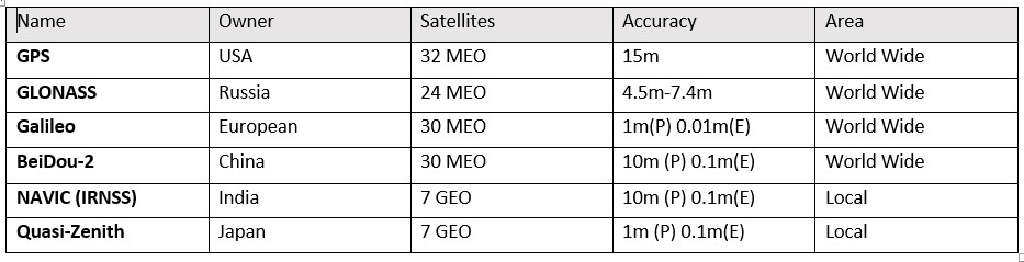
MEO – Medium Earth Orbit, GEO – Geostationary Earth Orbit, Accuracy (P=Public, E=Encrypted)
Global Navigational Satellite Systems include;
SBAS (Satellite Based Augmentation System)
For improved accuracy, many systems use SBAS. These use both GEO stationary satellites and ‘known’ ground-based stations to greatly improve accuracy. These receive the GNSS signal, and because they know their precise position are able to correct the GNSS and re-transmit it. This has greatly improved the accuracy of GPS, though you can see from the table above that the newer systems are very accurate without the requirement for an SBAS.
These SBAS systems are called;
WAAS – Wide Area Augmentation System USA
EGNOS – European Geostationary Navigational Overlay System Europe
MTSAT – MTSAT Satellite Augmentation System Japan
GAGAN – Geo Augmented Navigation India